Home | Nanga Parbat Main | Photo Index Page | Nanga Parbat References | Contact 
Previous photo Next photo Thumbnail page
05 Nanga Parbat On Flight From Islamabad To Skardu 06 Nanga Parbat Diamir Face And Mazeno Ridge On Flight From Islamabad To Skardu 07 Nanga Parbat Diamir Face And Mazeno Ridge Wide View On Flight From Islamabad To Skardu 08 Nanga Parbat Diamir Face And Summit Close Up On Flight From Islamabad To Skardu 09 Chongra Peak, Rakhiot Peak, Nanga Parbat Rakhiot Face And Fairy Valley On Flight From Islamabad To Skardu
First page Previous page Index page Next page Last page
07 Nanga Parbat Diamir Face And Mazeno Ridge Wide View On Flight From Islamabad To Skardu  [7 of 13]


Nanga Parbat (8125m, ninth highest in world) stands alone as the westernmost bastion of the mighty Himalayan Range. Nanga Parbat means Naked Mountain, named for its huge white massif consisting of a 20km long ridge called Mazeno on the south west and Rakhiot in the north east. It is also called Killer Mountain because of the number of people who died attempting the summit. It was finally conquered in a solo ascent without oxygen by Austrian Hermann Buhl in 1953.
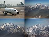
07 Nanga Parbat Diamir Face And Mazeno Ridge Wide View On Flight From Islamabad To Skardu Nanga Parbat (8125m, ninth highest in world) stands alone as the westernmost bastion of the mighty Himalayan Range. Nanga Parbat means Naked Mountain, named for its huge white massif consisting of a 20km long ridge called Mazeno on the south west and Rakhiot in the north east. It is also called Killer Mountain because of the number of people who died attempting the summit. It was finally conquered in a solo ascent without oxygen by Austrian Hermann Buhl in 1953.